21.12.2013 - 5.1.2014
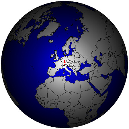
 For the third time I was on the road with a radio station in the Principality of Liechtenstein - this time at the turn of the year 2013/2014.
So it seems, that this small country has cast a spell on me.
The words "on the road" concerned only me himself, because as "base camp" and as permanent location for the radio station I chose once again the Mountain Inn Sücka (in German: Berggasthaus Sücka, www.suecka.li).
 The Mountain Inn Sücka (in German: Berggasthaus Sücka) is located near the winter sports center of Malbun at 1402 m (4600 ft) on a slope of the beginning Valüna valley.
This location way above the (new) car-tunnels from Triesenberg to Malbun is predestines ideally to have a rest complete.
And the restaurent in the house takes care of the physical well-being.
A smal note: You can not (!) reach the Mountain Inn in the winter with your car, because the in the summer available narrow street to the old tunnel is in use in the winter as sledge way.
In the winter there is a rigid ban to drive.
In addition to drive a mirror like street up or down with a gradient of approximately 20 % it's not everyone's cup of tea.
Who want to go to the Mountain Inn, who park his car at the large parking place in the valley near the bus stop "Steg/Tunnel" and walk on the hiking trail in the forrest or on the sledge way.
You arrives at the Sücke in about 20 minutes.
Here you can find the exact location.
Big pieces of luggage will be transported up by request (via telephon) with a shuttle service.
Activities in and around Malbun ![]()
 There is no necessity to limit himself to the ski slopes during a winter holiday in Liechtenstein.
This illustrates also the webpage Winter in Liechtenstein.
Also if the oldest resident of Liechtensteiner (the foehn wind) whooshes round the house corners, one can spend the time there also relaxed.
All in the winter existing ski slopes (all level of difficulty), cross-country ski trails, skater ski trials and footpaths are schedules in the brochure "Winter map" by Liechtenstein Tourismus.
The footpaths are marked with pink painted poles and sign-board and are at all times in mint condition.
You can't miss these footpaths even so there is deep snow.
Directly at the Mountain Inn begins the 1000 m long natural sledge way, which is lit up far into the night - You can rent a sledge at the Mountain Inn.
If you prefer cross-country skiing, who to get one's money worth on the trails named Valünaloop.
A lenght of 3 km of these circular trails are lighted.


Who want to enjoy the overlook at the mountain summits, should visit the mountain restaurant Sareis (in German: Bergrestaurant Sareis).
The Sareis is accessible with the chair lift of the Bergbahnen Malbun, as well as via the footphat, which begins at the church in Malbun.
A look at the webcam at the mountain station of the chair lift provides the proper overview and clarity about whether the way up is worthwhile.
But remember: The weather quite once can change quickly in the mountains.
Even if the mist hangs on the summit if you starts your way up, it can be sunny up there.
Or in valley thick fog is present, while the sun is shining above.
Hiking tours ![]()
I borrowed again snowshoes and sticks in the municipality of Malbun at Malbun Sport, like in the last winter holiday.
Equipped like this I walked as often as possible on the sometimes and in places relatively deep snow.
To walk on the marked winter footpaths it is not required to use these equipment, because these paths are at all times compacted.
But who wants to walk aside these paths or walk cross-country, who should take along snowshoes.

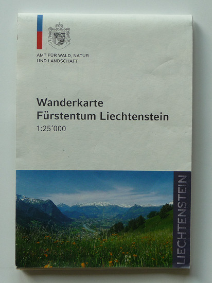 During the winter you can walk nearly on all paths listed on the hiking map or at Liechtenstein Tourismus and/or at Landesverwaltung only restricted.
The hinking map on the right is buyable also in the Mountain Inn.
The reason for the restricted accessibility is easy-to-understand: In the mountains there is during the winter from experience a lot of snow.
So you can't see the markings.
Only sometimes you can discover a painted marker on a tree trunk or a pole is langer than the deep snow.
Normally the paths in the Rhine valley are covered with lesser snow than the other ones aside.
In addition the level of the snow will gain height with higher level about the sea level.
Regardless I advise some tours aside the winter footpaths.
But I can't give a guarantee for the accessibility.
The accessibility for hiking there is dependent on weather, snow level and in the end of your condition and the legacy equipment.
You can execute all tours also in the opposite direction like described, but in the prefered direction it is easier to walk (more down than up) or the path is easier to find like by tour 2.
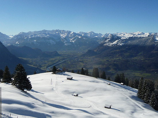
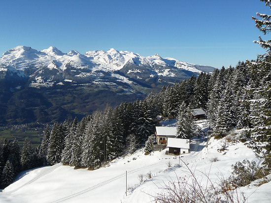
Tour 1 (Sücka - Silum - Gaflei): Starting at the old tunnel a little bit above the Sücka the way leads beneath the mountain crest at the slope located to the Samina valley partial in the forrest to a view point (1540 m) above Silum.
From Silum (1469 m) the way leads proceed in the direction to Bargella and Fürstensteig, but you can follow this way at the side of the Rhine valley at least to the turn-off to Alp Bargella (1663 m) and so called Kamin.
If you want so you can take an additional walk to Bargellasattel (1742 m), but you should include about 40 minutes for both ways.
The way back starts above the parking place of Gaflei (not at the place) and leads above the mountain restaurant Matu at the slope of the Rhine valley again to Silum.
There you have the choose between the way you walked already from Sücka to Silum (in the Saminatal valley) or the way in the Rhine valley partial in the forrest to the other side of the old tunnel.
This way is partial small, so it might well unpossible to walk there safely if the snow level is high.
Estimate about 2.5 hours for the whole way.
Who wants to walk the whole way, who can turn back to Sücka in Silum, whereby the way requires only about 1 hour.
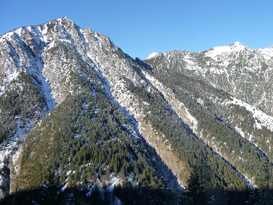
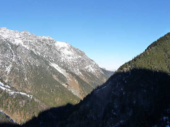
Tour 2 (Sücka - around the mountain Schönberg - Malbun): Starting at the Sücka the way passes the parking place "Steg/Tunnel" (1276 m) and leds at the end of the winter footpath in the direction of the Valorsch valley.
The part to Hindervalorsch (1456 m) leads reasonably planar across the forrest.
But after it you should use absolute snowshoes and pursue the way to Guschg.
The valley slope on the other side lies in the sun and there are a few trees.
In view of the avalanche risk you should avoid to walk on this valley slope.
Shortly before the junction to the Alp Guschg the (right) way leads to Sassförkle (1786 m) and from there the winter footpath down to the valley station of the ski lifts (above Schneeflucht) or to Malbun/Church (1600m).
For the way back to Sücka you shold use the Bus by LIEmobil until the bus station "Steg/Tunnel".
The way along the street is unpleasantly to walk.
Estimate about 5 hours for the whole way to the valley station or to Malbun.
 Tour 3 (Sücka - Masescha - Vaduz): This way leads through the old tunnel down to Mitätsch (1273 m) and to Masescha (1240 m).
In Masescha use for 100 meters the street an bend off to Hinterprufatscheng (1107 m) and the ruins of the wild castle (847 m).
The last part to the ruins leads down in the forrest on a small path.
Be steady on this part if the snow level is high.
 After the ruins is reached the way leads on the shortes way to the castle of Vaduz (600 m), when there is a abbreviator in the last part across the castle forrest.
This is a long tour, but the way leads mostly flat or down, so you should estimate about 3.5 hours for the whole way.
From "Vaduz/Post" use the bus line 21 in direction to Malbun until the bus station "Steg/Tunnel" and after that the way back to Sücka.
But be in mind: In December/January around 5′clock in the afternoon the darkness begins.
At this time it's getting dark fast, so paths are barely visible.
You should be at the latest at this time near of houses or on the streets.
If you be unsure whether you can finish a tour, so please start at the next day and respective earlier.
Radio station ![]()
In addition to regenerate in the winterly nature, I also relaxed as HB0/DK3RED/P at the radio station.
And the results surpass all expectations.
As transceiver I used again an Elecraft K1 for 40 to 17 m with 5 W output power feeding a self-made multi-band antenna.
During my first activity from the Mountain Inn I used a relatively small antenna.
I kwew the house only from the oudside and I could not assess, from which room I could erect an antenna in which direction.
The small antenna I would have to erect and to fixate in cases of need vertical with a mast out of the window - but there was no case of need.
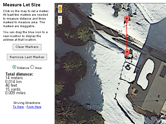 This time I kwed the location, but I had not measured any distances, because there was deep snow at the slope.
But you can use the webpage www.findlotsize.com in the run-up for it successfulness.
One have to know (or anticipate), what the paticular things are at the satellite picture in actuality.
This webpage is designed mainly for meassure the area of a property.
But it is also well suited for example to investigate distances to maybe usavailable fastening points.
You insert the adress, zoom to the right area, click on "Distance" and set two markers.
Thereafter the seached distance will be displayed.
Based on this information I could build a essentially larger antenna.
I was active as often as possible in CW at the late afternoons and/or early evenings (holiday stile).
On altogether 14 days I could reach in about 31 hours total 403 QSO's.
Many QSO's I logged on 30 m (74 %), followed by 40 m (22 %).
QSO's on 20 m and 17 m there wasn't productive - each 2 %.
As exepted there were in the 37 reached DXCC entities many stations from Europe.
But I reached also some DX stations from the Asian part of Russia and the United States.
Especially the QSO's on 40 m to to W7ZI (8332 km) at the west coast and to K0RF (8378 km) in Colorado was a pleasure to me.
Maybe there was for ea short time a "link channel" open, because I logged at sunrise (grey line) several QSO's to the USA in a row.
The reached stations were located on 3 continents (NA, EU, AS) and in 9 CQ zones (WAZ 3, 4, 5, 14, 15, 16, 17, 20).
Per day I registered between 3 and 87 QSO's in the logbook.
For me, this result is again by far more than I had expected, especially when I come to consider the few hours spent at the radio station and the low output power.
Even though it was sometimes laboriously I called CQ in the mean time.
Only some special stations I called direct - with success after one or two trials.
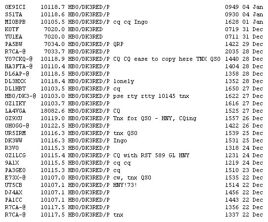 The operators of two radio stations told me after the QSO's, that they listed my callsign in the DX cluster.
But the run to kept within limits or was unobservable.
At other moments I observed, that somebody inserted my callsign in the DX cluster.
But seen altogether around the used frequencies it was quiet.
Sometimes it was necessary to move some Hertz, because a station, which I received a strong station loud but the operator not noted my weak signal and started 100 Hz higher with his CQ call.
But it wasn't a great worry to me: There is a VFO knob at my transceiver and no necessity for a channel pitch on the bands. ;o)
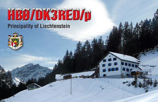 QSL cards for all QSO's are in preparation from the QSL-Shop.
The cards are shipped of course after the completion via the QSL bureau of the German Amateur Radio Club (DARC e.V.), without having to wait for incoming QSL cards.
Nevertheless if the QSO partners receives they QSL cards "without work" I would be happy about receiving QSL cards, because I'm a QSL card collector.
When I came back to Germany some direct confirmations was even in the mailbox.
Between the cards was also a SWL report, which pleasered me again and again.
Addendum on 25.1.2014: All QSL cards was sent today via the QSL bureau.
 During a QSO someone asked on the band, if my activity also counts for the SOTA program.
I had to negate.
The summits was, because it was winter, coverd permanent with snow.
In addition the avalanche risk was high, because the was warm periods with foehn wind and periods in which thick snow began to fall.
And one can't see any markers at the stones along the way up in the winter.
In addition the holes and creeks are unvisible and are another hurdles.
To walk in the winter is more difficult as to walk on the tours described above.
Expression of thanks ![]()
A very big thank you goes in this way to the family Schädler as operator of the Mountain Inn Sücka (www.suecka.li).
Very soon I felt well integrated in her cozy house.
And I thank you again for the opportunity to be able to be active with a radio station there.
This is at the present time not everywhere like this.
But I was not the only radio operator, who treasured these advantage.
This fact evidenced the QSL card of a group of operators from the Nederlands, which is displayed in the restaurant.
The landlady said, the Dutch men reside at the Sücka already since several years at the end of november (to the WW DX CW contest?).
Also I would like to thank all, who were able to hear my weak signals.
It has been very much fun to me again.
I hope to have helped one or the other to reach a new DXCC entity or at least a further point on the way to one or another award.
Although Liechtenstein should probably not be listed in any "most-wanted" list, there is a large demand for a QSO with an amateur radio operator in this DXCC entity.
Would this circumstance not convince you, to be activ for a more or less long period as ham radio operator from Liechtenstein?
Since Liechtenstein signed the CEPT agreement, there is no necessity to apply a special license, so you could become active without problems.
Only you have to bring yourself to visit Liechtenstein with a radio station.
There is no necessity to plan a full time DXpedition with technical equipment in barrels.
An activation in holiday stile is enough in most cases.
And one can spend the times between the openings of the band very well.
73/72 de Ingo, DK3RED - Don't forget: the fun is the power!