10. - 17.6.2017
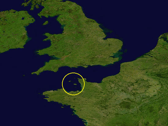 Jersey is one of the Channel Islands, a group of islands in the southwestern part of the English Channel near France.
Geologically, all Channel Islands belong to a massive, which is at least 400 million years old.
Only after the last ice age about 6000 years ago they became islands.
All the islands share a climate influenced by the Gulf Stream.
The Channel Islands are Crown dependency of the United Kindom.
The picture on the right is the excerpt from a satellite image of NASA/Goddard Space Flight Center (Source: Wikipedia).
 The Channel Islands are divided into the Bailiwicks of Jersey and Guernsey.
Jersey includes the uninhabited islands and rock groups of Les Dirouilles, Ecréhous, Minquiers and Pierres de Lecq, along with Jersey.
Guernsey includes, in addition to Guernsey, Alderney, Sark, Herm, Brecqhou and Jethou as well as the uninhabited islands and rock groups Burhou, Lihou und Casquets.
On all Channel Islands, approximately 166000 people live together, on Jersey about 100000.
Impressions ![]()
I visited three of the Channel Islands during a trip organized by Rotel Tours.
The Mayfair Hotel in Saint Helier served as a place to stay.
Saint Helier is one of the twelve parishes of Jersey.
It is with a population of around 33000 inhabitants the largest city and capital of the island.
After the flight in the late afternoon, the day 1 was left for a short walk through Saint Helier.
 The entire day 2 was reserved for a round trip on the island with its 120 km².
First we drove to the southeast corner of the island, to La Rocque Point.
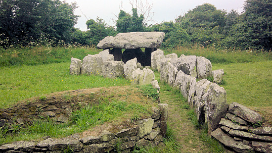
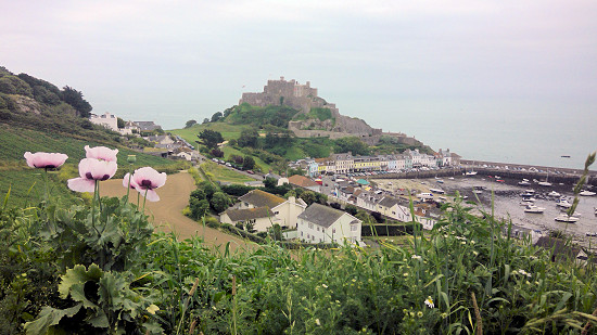
After a short detour to La Pouquelaye de Faldouet nearby Gorey, one of the 15 still preserved megalithic structure (dolmens) on the island, we went to Gorey itself.
Over this little place is enthroned Mont Orguell Castle.
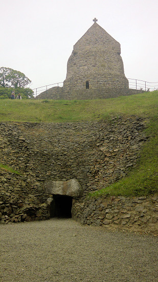
 The Museum of La Hougue Bie offers one of the ten oldest buildings in the world.
It is a passage grave that is oriented to the sun and which was built about 6000 years ago.
Already in the Middle Ages, a chapel was erected on the hill.
The tomb was not opened until 1925.
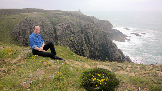
Our trip then took us with a short stop in Greve de Lecq to the northeast end of the island, to the Groznez Point.
There are still the ruins of Groznoz Castle preserved and unfortunately one of the many defensive installations built during the World War II.
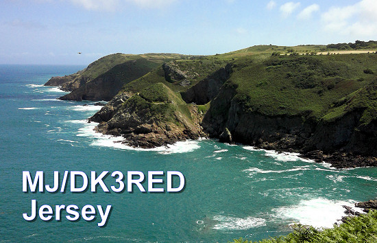
As can be seen in the photo, the north coast of Jersey is a cliff.
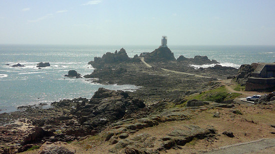
 At the southwestern end of the island stands at Corbière Point one of the many lighthouses on a rather low hill.
The tower is only accessible on foot at low tide.
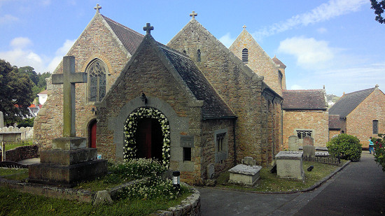
Only a few monastic monasteries survived the Reformation in the 16th century.
One of the few bildings is the Fishermen's Chapel, a small chapel next to St. Brelade's Church in the town of the same name on the south coast.
Some old paintings are still preserved in the chapel.
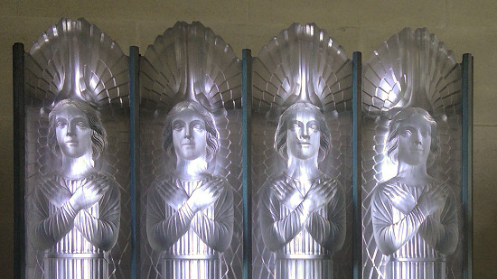 On the return trip we visited the St. Matthew's Glass Chuch.
Glass is known to be used in the form of colored windows in almost every church.
But to the extent that the French artist René Lalique used it in 1934, I have not yet seen it.
The entire equipment, from the baptismal basin to the cross and the Holy Pictures, is made of cast, translucent white glass.
This looks modern but also very cold - at least for me.
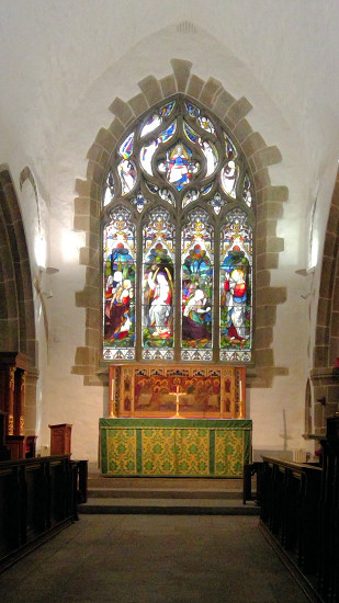 Much better I liked the Parish Chuch in Saint Helier, which was visited on day 3 during the city tour.
The capital itself is, like many big cities, overflowing.
But if you want to buy cheap, you can find a shop with the products you are looking for.
If you are moving to the sea, the many benches with names and numbers on the beach will be covered.
They're supposed to remember the ships sunk off the coast of Jersey.
You can find information about the shipwrecks also on the map, see below.
 The next two days were reserved for the neighboring islands.
On day 4 we rode a catamaran from Saint Helier to Saint Peter Port on Guernsey.
About 62500 inhabitants live on this 63 km² large island.
In addition to a ride along the impressive coastline, I can only recommend a tour through Saint Peter Port.
With its winding streets, the city, formerly a Norman harbour, has preserved an irresistible charm.
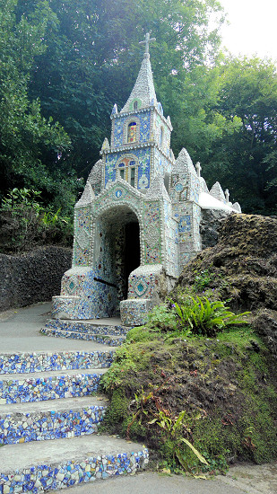
Tourist magnet is Little Chapel in Saint Andrew inside the island.
It is supposedly the smallest but officially consecrated church in the world and also decorated with colourful mosaics and mussels.
It is actually the third chapel at this point.
The first, built in 1914, was demolished after criticism by other faith brothers.
The bishop, who arrived in 1923, did not fit through the door of the second chapel, which was built a few months later.
Therefore, shortly thereafter on an area of 4.9 × 2.7 m was started with the construction of the now still to be seen version.
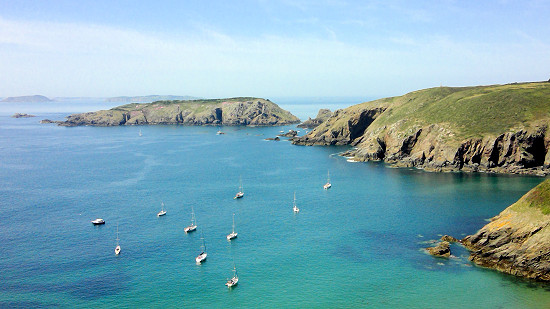 On the day 5 we used a slightly smaller ferry to Sark.
Since there are no cars there, the life of the approximately 500 inhabitants runs very quietly.
The main transport is either the tractor or the (rented) bicycle.
Even the ambulance is pulled by a tractor.
We drove with a horse car to visit in just over an hour the attractions of the only about 5.5 km² large island.
The island can also be easily explored on foot.
While the tour group travelled with the horse carriage to the gardens of the Seigneur of Sark, I went out with a small group at the crossing to the peninsula Little Sark.
This part of the island can be reached by land only over a ridge of up to 100 m high (La Coupée), which has only been a railing since 1900 and was developed in 1945 by German prisoners of war to a narrow road.
You can refresh yourself and enjoy the tranquility, for example in the small tea garden there.
The fine restaurant next door did not seem appropriate to us in terms of our hiking clothes.
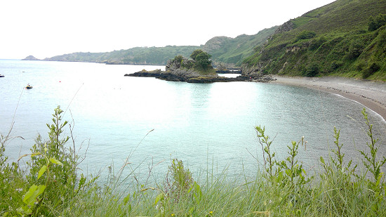 Day 6 represented a "garden tour" that began at Judith Quérée's Garden in the northwest of the island.
The owner has equipped a private, and thus normally not accessible, garden with about 2000 plants, which is a little more than 1000 m², so that there is virtually no room for weeds.
After a stop at the Bouley Bay in the north (coffee and cakes are available at Mad Mary's Cafe right on the beach) it went on to St. Catherine's Bay in the east of the island.
The Eric Young Orchid Foundation further inside the island houses orchids from all over the world.
This unique orchid exhibition has won several awards.
If you want to, you can also (from outside) take a look into the greenhouses.
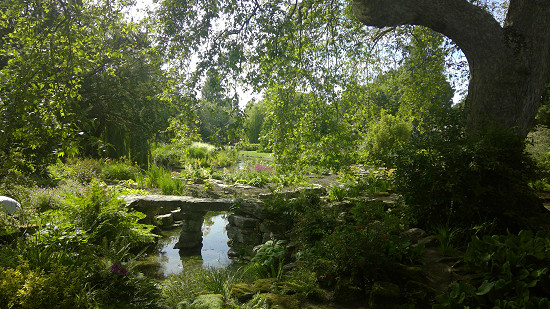 The completion of the day tour was made by the Botanical garden at Samarès Manor.
Thematically or geographically sorted, there are almost every plant that grows somewhere in warm areas of the earth.
This is how tulip trees and strawberry trees are found as well as cacti and succulents.
In the years after 1920, the shipping magnate Sir James Knott laid out this garden, accessible from April to October.
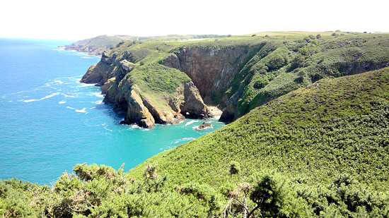
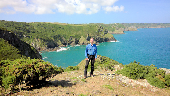 If you wish, you can also walk around the island.
Relatively well signposted hiking trails are available along the entire coastline, mostly above the cliffs.
On day 7 we took at least a short hike on the cliffs on the north coast.
Its started at Sorel Point and headed west to Greve de Lecq.
Please provide sufficient time.
For one, the paths lead to offshore (near the sea) and you have to avoid any small indentation (bay).
On the other, the views are spectacular.
Both together, thus hiking and at the same time enjoying the view, inevitably leads to stumbling on the partly stony paths.
Moreover, the descent to an interesting point, as with us Devils's hole (see QSL card below), requires extra time.
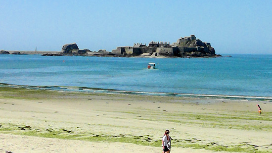 As the departure took place on day 8 in the evening, there was still plenty of time left to review the impressions of the trip on a walk along the beach of Saint Aubin's Bay from Saint Helier to the name-giving location.
On my list for a possible next visit to Jersey is, among other things, Elisabeth Castle.
It can be reached at low tide on foot and at high tide with an amphibious vehicle.
But beware of hikes during the low tide!
The tidal can be up to 13 m on Jersey.
It should also be noted that the tide comes very quickly due to the shallow seabed.
For orientation on Jersey, the map already laid out in the airport building is enough.
On the one hand, the map of Saint Helier and on the other the map of the entire island is printed in scale 1:25000.
On the map you can see all the side streets and the bus and tourist attractions.
For Guernsey and Sark, similar maps are available on the ferries or at the landing ponits.
For the exploration of Jersey, both rental cars and the dense bus net are available.
Although remoted places are sometimes only hit twice a day, the tourist strongholds are connected in hourly intervals.
The street names and city names are a colourful tangle of English and French terms, so the correct pronunciation sometimes puzzles.
In addition to English, there is sometimes a Norman dialect (Jèrriais) spoken on Jersey by older people.
However, this dialect differs so much from the standard French that only the native islanders themselves understand it - and not all of them.
For this reason, the dialect is no longer a compulsory subject in schools.
Amateur radio ![]()
Since the Balliwicks of Jersey and Guernsey are independent political units, separate DXCC entities exist on them.
The Channel Islands are all CEPT countries.
Therefore, it was not necessary to obtain a guest license in a complicated way.
The licence of the home country is sufficient to act as a radio amateur.
The schedule during the day trips to the islands of Guernsey and Sark (both belonging to GU, IOTA EU-014) offered no opportunity to build the station.
Therefore, only the time on Jersey (GJ, IOTA EU-013) remained to indulge my hobby.
The construction and operation of a radio station on the beach about 10 minutes away from the hotel would have been possible at any time.
Before, however, I asked the hotel manager if he would approve the construction of an antenna.
His comment: it's fine!
So I built an aerial on the sun patio on the second floor on the sight protection to the street and in my adjacent room the station.
 As transceiver I had my Elecraft KX3 with built-in antenna tuner.
A 13 m long dipole according to Karl Hille, DL1VU, on a 10 m high telescopic mast served as an antenna.
This dipole I build as groundplane, more specifically than as Up & Outer.
A branch was vertically to the mast, the other horizontally on the upper edge of the wooden fence.
I led the 2 wire line through the tilted window.
The mast, which was not completely pulled apart, could be fastened to one of the fence posts with rubber bands.
In addition, a Palm Single and a Tablet PC were used for keying.
The power supply formed by a LiFePo4 battery with 4.5 Ah capacity.
Attention: Please do not forget the travel adaptor!
The hotel rooms have many outlets with 230 volts alternating current, but all outlets are of type G.
Otherwise, only the outlet for the razor in the bathroom remains to charge the batteries.
So I was able to equip as MJ/DK3RED from the hotel on Jersey at two days (mostly evening) within a few hours on four bands (40, 30, 20 and 10 m) total 38 QSO's with European stations in 15 DXCC entities (DL, EI, EU, F, G, I, LA, OK, ON, OZ, PA, RAeu, S5, SP, YL) in 3 zones (CQ 14, 15, 16).
Fortunately, many connections came to the MJ-logbook during a Sporadic-E phase (ES) at 10 m.
Already on my return from Jersey, a direct QSL card was in the letter-box and the request of a short-wave listeners in the e-mail box.
All QSL cards were sent over the bureau on 23.6.2017, direct request two days before.
I thank all those who were able to record and respond to my silent signals.
73/72 de Ingo, DK3RED - Don't forget: the fun is the power!